
MEL COVEY


Before the European contact period, “Indian Town,” as it was known to the colonials, was the principal aboriginal village on the barrier island of Croatoan and was the center of activity for its inhabitants. Quite possibly, it was also the refuge destination for at least some of Sir Walter Ralegh’s missing colonists, popularly referred to as the ‘Lost Colony.’ This area of southern Cape Hatteras is positioned near the southeastern corner of Pamlico Sound in what is today northeastern Frisco, North Carolina – historically known as a part of Trent.
Read more about Covey's

A Continuing Conflict for Chicamacomico's Camp
Live Oak By Mel Covey
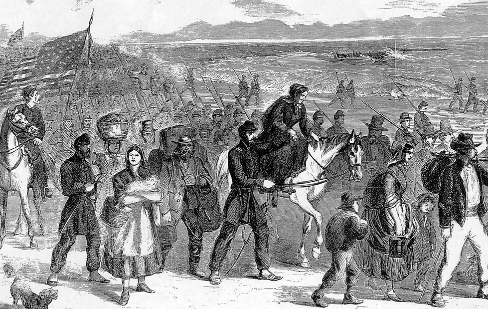
A Continuing Conflict is the fruition of findings which culminated from a thoroughly objective investigation into the controversial subject of the Chicamacomico Races.
What was previously thought to be only a minor military footnote, that played out during the early months of the American Civil War, has now been reexamined and reinterpreted. What emerges is a historical account reading much differently from its published predecessors. This latest effort will assist in subsequent reevaluations. It will also facilitate a better understanding of Cape Hatteras' strategic importance to the war effort of both parties engaged in America's epic conflict. What happened along Hatteras Island's shores, and its adjacent waters, altered the course of American history. Many events transpired in coastal North Carolina affected actions that continue to reverberate long after the guns have been silenced - but, not its discussion.
Croatoan's Old Indian Town Revealed By Mel Covey
On the 7th day of March in 1759, Arthur Dobbs, Captain-General, Governor, and Commander in Chief of North Carolina issued a 200-acre land grant to “William Elks and the rest of the Hatteras Indians” on Currituck’s South Sand Banks. From that date forward, what remained of the natives’ homeland surrounding their chief village on Cape Hatteras became the Indian Patent. This was conclusively documented by various land grants and deeds extending forth into the 1840's offering ownership of property that was a mixture of parallel, forested sandy ridges separated from each other by glades of fresh-water marshes. As specified within its described boundaries was Old Indian Town(e), found mentioned in adjoining grants issued between the years 1712 and 1716
IN THE NEWS
February 26, 2019 The Virginian Pilot
So-called Indian Ridge Linked to Lost Colony By Local Researcher By Jeff Hampton